top of page
Applied Economics Ph.D.
Africa and Middle East regions
Here you can find different types of projects executed across Africa and the Middle East.
Estimating wealth across african countries
I estimated wealth at high resolution across the African continent as part of a project aimed at evaluating the impacts of heat doing an intra-city analysis. I used GIS techniques to create spatial joints between temperature variables and socio-economic information.
Software: R, ArcGIS Pro.

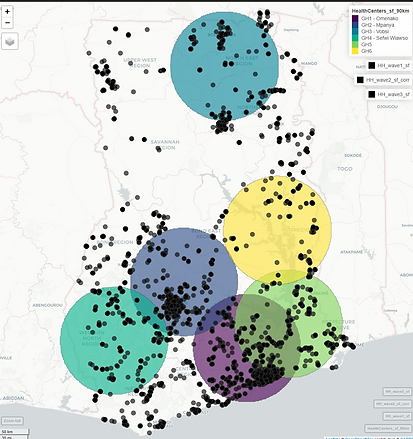
Evaluating the link between health centers and development indicators
I harmonized three years of Ghana's household surveys to understand if households closer to healthcare tend to show increased health conditions. Each circle represents a healthcare center. I used radial euclidean distances to associate each household to the closest center.
Software: R, Stata, ArcGIS Pro, Python.

bottom of page